Hisar - Prokuplje

Originating at the foot of the mountains Jastrebac, Pasjača and Vidovača, at an altitude of about 300 meters, Prokuplje with its geographical position, archaeological discoveries in it and the surrounding area and preserved remains of monuments from the past, reveals the image of a long-established city. On the southwest side rises a picturesque hill called Hisar, around which the snake-like Toplica is wrapped and on which still stand the dilapidated remains of the ancient city. Everything that happened here for centuries, good and evil, happened under the steep slopes of this hill, so Hisar is the eternal symbol of Prokuplje.
(Slobodan Nestorović, Pod Hisarom, 1979)
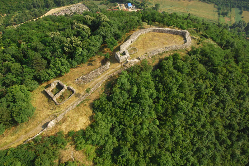
The remains of a medieval fortress are located above today's Prokuplje on the hill Hisar, which is surrounded on three sides by the river Toplica. Research conducted during the 1970s and 1980s indicates that this area was established in the second half of the 14th century or the beginning of the 15th century, probably in the period between 1371-1389, in order to defend against the Turks. The Turks occasionally occupied Prokuplje in 1440, and finally occupied it in 1454. They soon rebuild the occupied fortress and place the crew there, and their population in the suburbs. The fortification consists of an oval-shaped citadel on the highest plateau, from which two concentric ramparts descend, forming two suburbs on the accessible parts of the slope. As a protruding stronghold on the banks of the river Toplica is the best preserved so-called Jug Bogdan's Tower. It is assumed that it controlled the crossing of the river and played a role in supplying the fortifications with water.
- Total Visitors: 745171


